Overview
Climate extremes across the Indian subcontinent and surrounding oceans are increasingly driven by anomalous thermodynamic and dynamic shifts within the coupled ocean-atmosphere system. Tracking these extremes reveals how sustained marine heatwaves and unusual subsurface ocean warming rapidly intensify pre-monsoon tropical cyclones, while complex atmospheric interactions — such as the coupling of subpolar and subtropical jet streams — trigger devastating inland rainfall events. Ultimately, these phenomena highlight a shifting regional baseline where isolated weather systems are continuously amplified by persistent, large-scale warming patterns.
Focus Areas
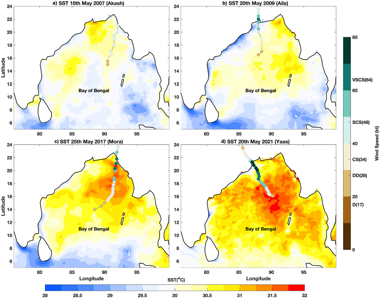
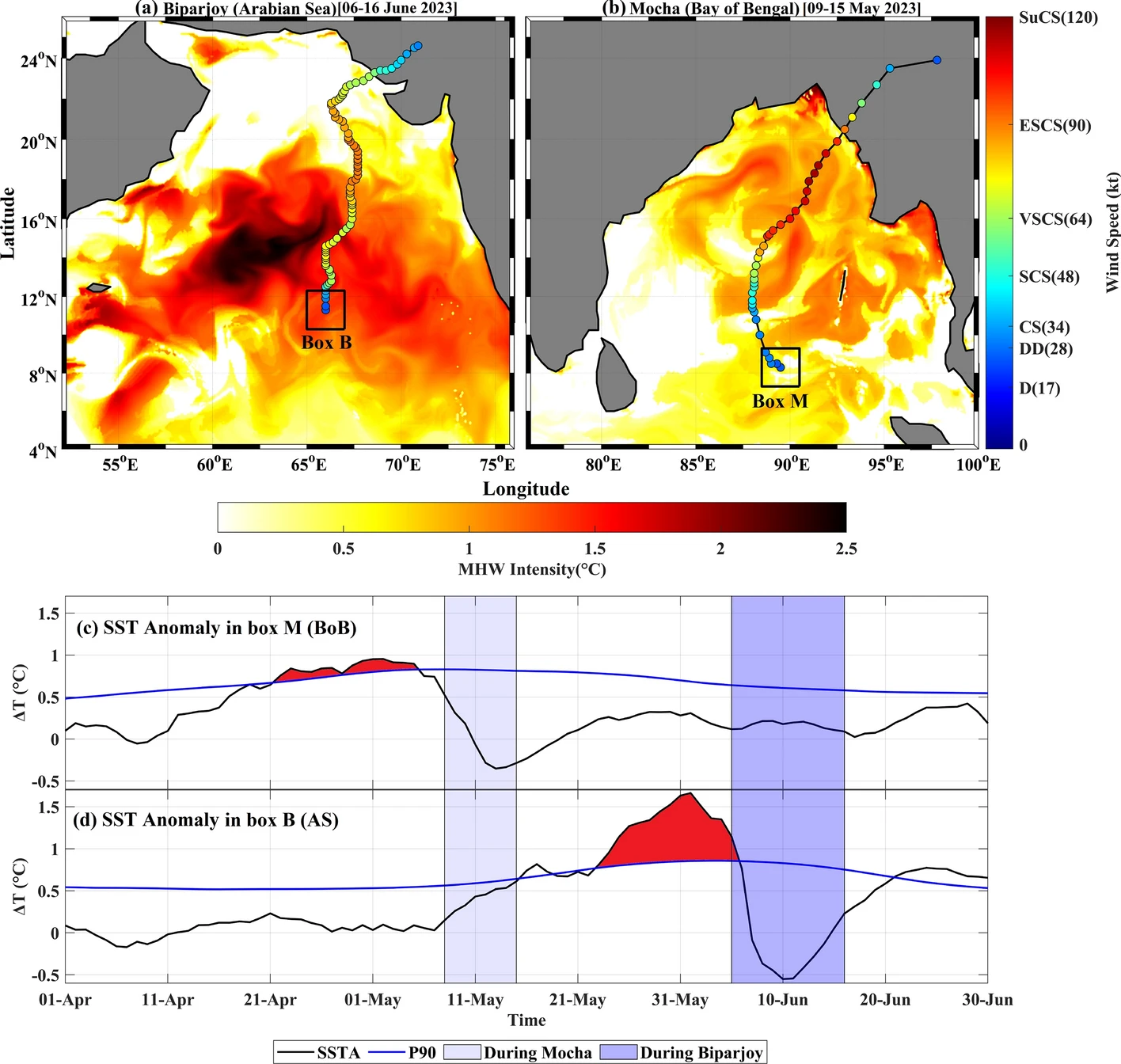
- Analysis of how anomalous surface warming, severe marine heatwaves, and subsurface heat content directly drive the rapid intensification of pre-monsoon tropical cyclones.
- Evaluation of the thermodynamic impact of low-salinity plumes and barrier layers on the accumulation of Tropical Cyclone Heat Potential prior to cyclogenesis.
- Tracking the complex interactions and anomalous coupling between subpolar and subtropical jet streams in the upper atmosphere.
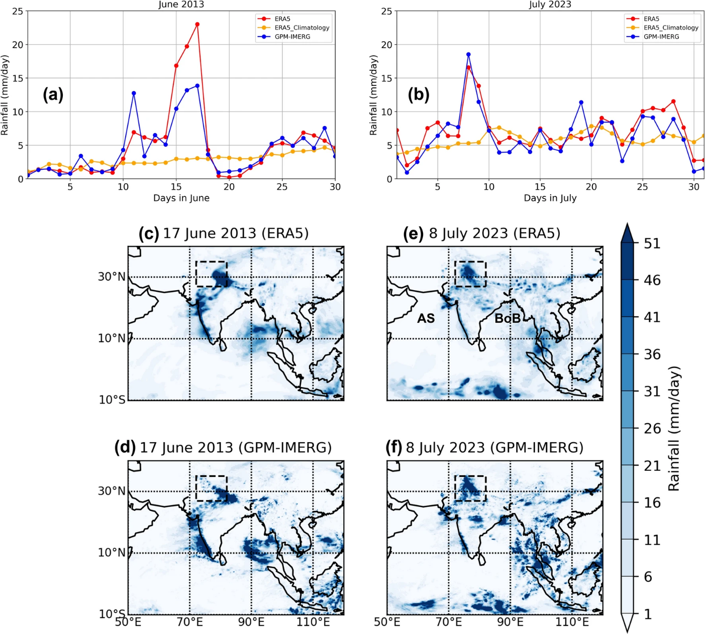
- Investigation of how these shifting jet stream dynamics triggered unprecedented extreme and localized rainfall events over the North Indian Subcontinent.
- Analysis of the atmospheric mechanisms, including sustained anti-cyclonic circulation and subsidence, that reinforce and prolong extreme marine heatwave events.
- Quantification of how long-term environmental warming trends compound with short-term synoptic anomalies to escalate overall regional disaster severity.
Interesting Results
Why It Matters
Understanding the precise physical drivers behind rapidly intensifying cyclones, severe precipitation anomalies, and prolonged heatwaves is essential for accurate extreme weather forecasting. As continuous warming alters the thermal limits of the ocean and the trajectory of atmospheric jet streams, these insights provide the critical framework needed to upgrade early warning systems and protect vulnerable populations from compounding disasters.