Overview
The intricate physical oceanography of the Bay of Bengal, characterized by multiscale sea level variability, coastally trapped Kelvin waves, and shifting upper-ocean stratification, fundamentally governs regional marine dynamics. Advanced numerical simulations bridge the gap between these physical observations and predictive applications by utilizing regional ocean models such as CROCO to quantify pre-cyclone thermodynamics and employing trajectory frameworks like OpenDrift to compute dynamic surface transport. Together, these observational and computational approaches reveal how persistent oceanographic phenomena dictate both the rapid intensification of extreme storms and the complex coastal drift of maritime objects.
Focus Areas
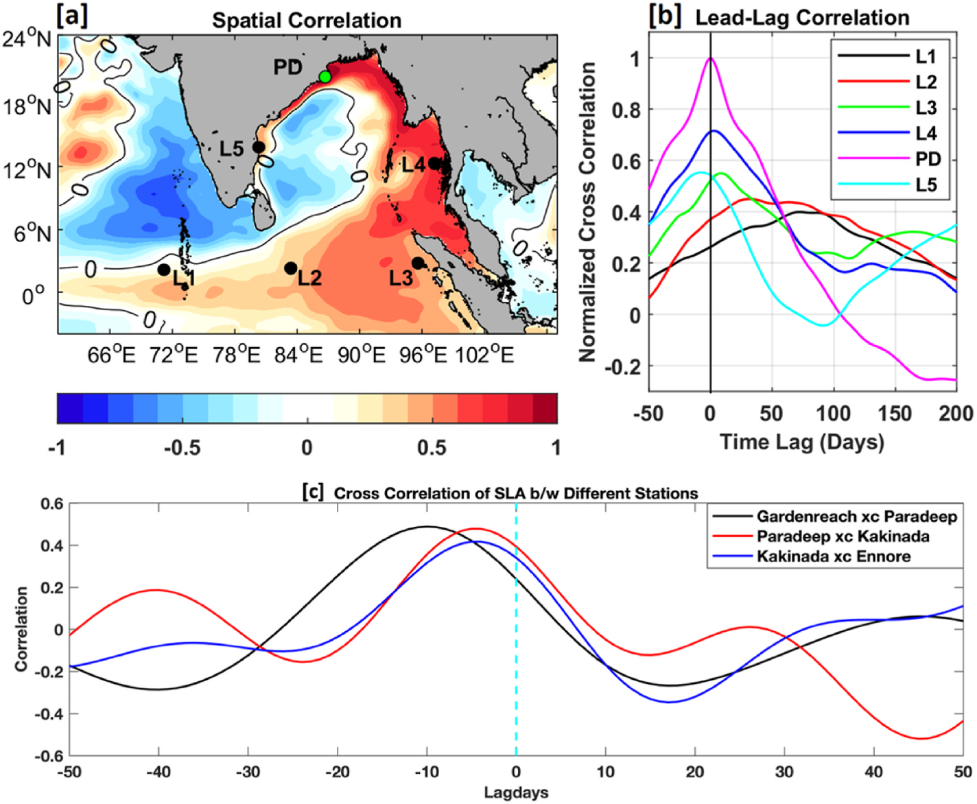
- Analysis of multiscale sea level variability, tidal constituents, and intraseasonal oscillations across the continental shelf using integrated tide gauge and satellite altimetry data.
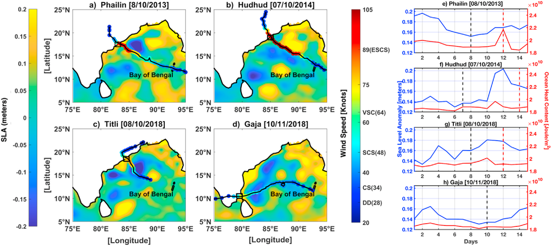
- Investigation into the mechanisms of coastal downwelling and its influence on upper-ocean warming to track its direct role in the rapid intensification of post-monsoon tropical cyclones.
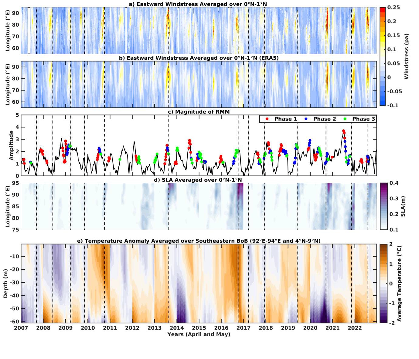
- Configuration of regional ocean models for multiple sensitivity studies to isolate the thermodynamic impact of westerly wind bursts, and localized latent heat release prior to cyclogenesis.
- Quantification of shifting isothermal layer depths and sea level anomalies to evaluate their contribution to accumulated oceanic heat in geographically favorable regions.
- Application of Lagrangian particle tracking models (OpenDrift) to step forward in operational oceanography.
Interesting Results
Why It Matters
Accurately capturing multiscale oceanographic variability and its thermodynamic feedback is essential for predicting rapid cyclogenesis in highly stratified regions. By linking physical observations with robust trajectory and regional ocean models, these numerical insights improve not only early warning systems for extreme weather but also the precision and reliability of critical maritime search and rescue operations.